|
NASSAU
COUNTY REGIONAL
STORM SURGE MAP
Prepared By New York State
Emergency Management Office
September 6, 2005
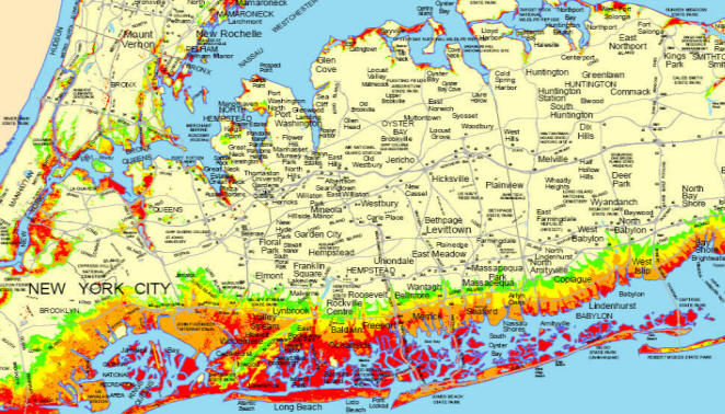
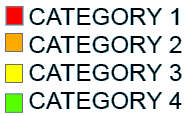
Hurricane storm surge
zones are based on NOAA's "Sea, Lake and Overland Surge
from Hurricanes (SLOSH)" model projections of sea level
rise (surge height) associated with category 1-4
hurricanes. Surge heights have been mapped against
coastal terrain to delineate inundation zones for each
storm category. Northwest tracking storms with
several possible landfall locations which occur at high
tide have been factored in the modeling to produce the
worst case flooding for any given area from any given
category storm (northwest tracking storms produce the
highest surge in the region). As these zones
factor several possible landfalls, no one storm of a
given category will inundate all areas delineated for
that category storm.
|